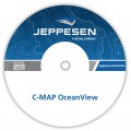
C-Map OceanView

OceanView is a powerful chart planning system for use on board and in the office environment. It is designed for back of bridge or Masters office installation or to be installed at companies such as ship-owners, shipbrokers, ship managers and ship operators. Based on the comprehensive C-MAP chart databases, this is a powerful decision support tool based on our worldwide coverage of electronic vector charts.
OceanView is Decision support tool and chart display software combining weather and piracy information with route planning.
Combine OceanView and the ECDIS
The combination of OceanView in the office environment and a CM-93/3 based ECS or ECDIS on board provides unique features to the operators. One important factor is the ability to exchange vital information between vessels and the office for instance import and export of route plans. When subscribing to the IMO´s Search & Rescue service (SAR). The ECS on board can immediately alert the mariner when the vessel approaches a new SAR area. This function is now mandatory on the passenger vessel.
Integrating charts and weather
- Astronomical water level and current
- Tropical cyclone warnings
- Easy downloading of Wind and Wave forecast
- Possibility to distribute or share the chart and weather information
- Always up-to-date
- Support HTTP (Internet) and e-mail
- Free 30 days trial

